|
||||||||||||||
| Home | Contact | |||||||||||||
ProjectOfficeActivities Info
Reference Data |
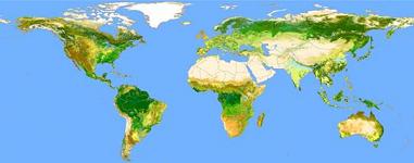
The GlobCover Project Overview The GLOBCOVER project was launched 2004 as an initiative of ESA which is now evolving to an international collaboration between ESA, FAO, UNEP, JRC, IGBP and GOFC-GOLD. The objective of GLOBCOVER is to produce a global land-cover map for the year 2005, using as main source of data the fine resolution (300 m) mode data from MERIS sensor on-board ENVISAT satellite, acquired over the full year 2005. This new product intends to complement and update other existing comparable global products, such as the global land cover map for the year 2000 (GLC 2000) with a resolution of 1 km produced by the JRC. Appropriate approaches for the validation of the land cover products are planned to be defined in consultation with CEOS. The GLOBCOVER collaboration
Contribution of GOFC-GOLD The GOFC-GOLD Land Cover Implementation Team plays an active role in the coordination and implementation in the validation of GLOBCOVER products. The validation methodology will based on the �best practice� document compiled by the CEOS Cal/Val group as outcome of the related workshops (see Harmonization & Validation Initiative. The general approach is to develop a "living" dataset of validation sites that could be used to validate any new land cover map. The sites will be selected in such a way that they are not associated with any specific land cover map and that they may retain statistically rigor when used on a variety of maps. The LC-IT will ensure that enough detail and information will be provided to validate the GLOBCOVER products. The actual validation uses high spatial resolution satellite image data (global LANDSAT mosaic for the year 2000, SPOT, ASTER etc.). International remote sensing experts interpret the local land cover characteristics and provide data for the statistical assessment of map accuracies. The international contacts will be mainly established through the GOFC-GOLD regional networks. In April 2007, ESA presented the first Globcover products (bi-monthly and annual mosaics) to the user community during the ENVISAT Symposium in Montreux (Switzerland). In May 2007, the 1st GLOBCOVER User Consultation Meeting was held at the European Joint Research Center (JRC) in Ispra, Italy. Read more in the GOFC Newsletter No. 15. :: News ::October 2008: The results of the GlobCover Project are available at the ESA IONIA Portal. After registration, the users have access to:
|
|||||||||||||
|
Copyright © by FSU Jena/GOFC-GOLD PO 2005-2011 | by CGI Wageningen UR/GOFC-GOLD LC PO 2012 | ||||||||||||||